Marin County
My first time trail running in Lagunitas was in Spring 2025 with my friend Sabrina. I had recently learned that in addition to the famous Gardener Fire Lookout on Mt. Tam, there is one other active fire lookout in Marin County–the Dickson Fire Lookout on Mt. Barnabe (I’ll call her Barny).
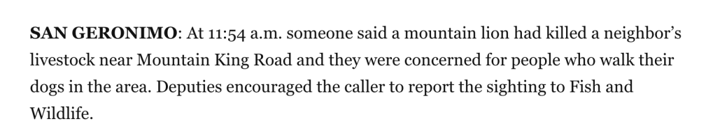
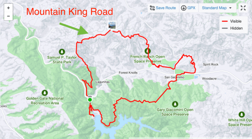
Neither of us had really ever run in the San Geronimo Valley. Our route had all the ingredients of a great run: lots of vert, big views, water at around half-way, redwood forests, grassy fields, cows, etc. It was still beautiful, don’t get me wrong, but required much more navigation than we had anticipated, had more pavement than ideal, and we were properly freaked out by Mountain King Road.
Mountain King Road, by the way, passes through (or along? unclear) private property where there are lots of A. cute livestock B. scary guard dogs. C. scary signs. But also mountain lions?
Since that run, I knew I wanted to come back to Lagunitas and try a different loop. I found out that Bill’s trail, the one that runs along Barny’s backside, was well reviewed and had a pleasant grade. Then I realized that the northern section of the Bolinas Ridge trail was nearby. Toss in a heaping cup of Shafter Grade, a couple tablespoons of Jewel Trail, a dash of the Cross Marin Trail, and a pinch of of Sir Francis Drake and Devil’s Gulch Rd, and you’ve got one delicious adventure run.
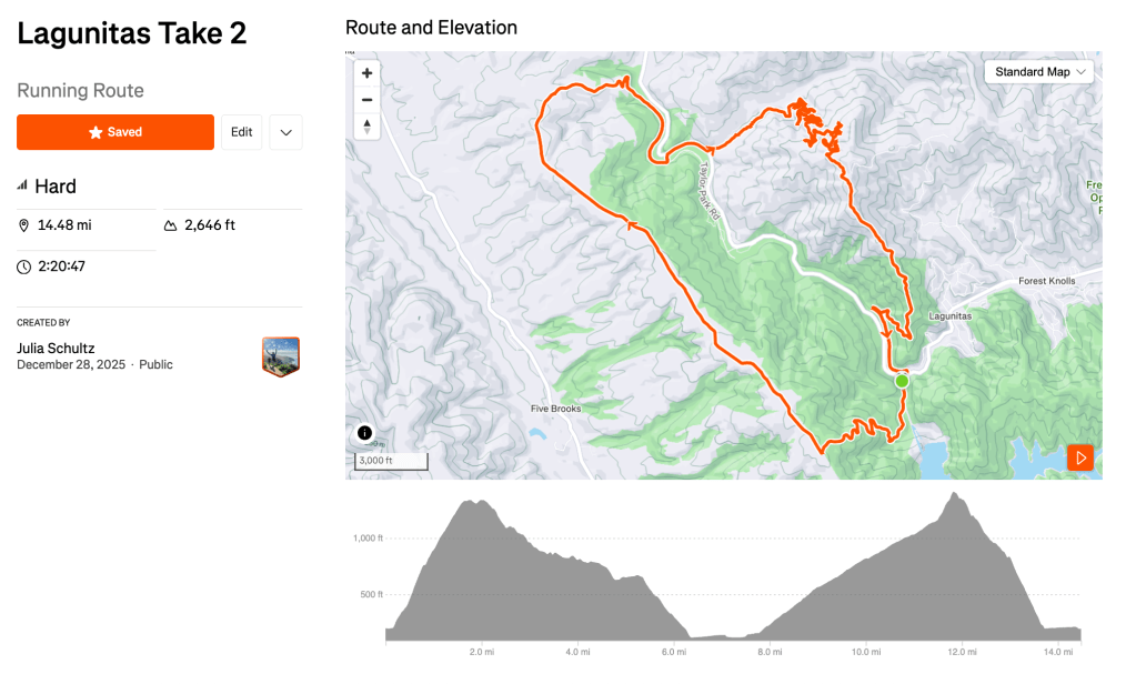
https://www.strava.com/routes/3440167675246383584
For parking, go to the Leo Cronin Fish Viewing Area. I recommend getting there before 10am. I know bed is cozy and warm and morning dilly dally is calling — but the parking lot is not big and will likely be full later in the morning. The parking lot does not have water but does have a bathroom.
Start by following Shafter Grade and continue following Shafter as it veers right and up. Shafter is a pretty punchy climb with 1,100ft in 1.5 miles.

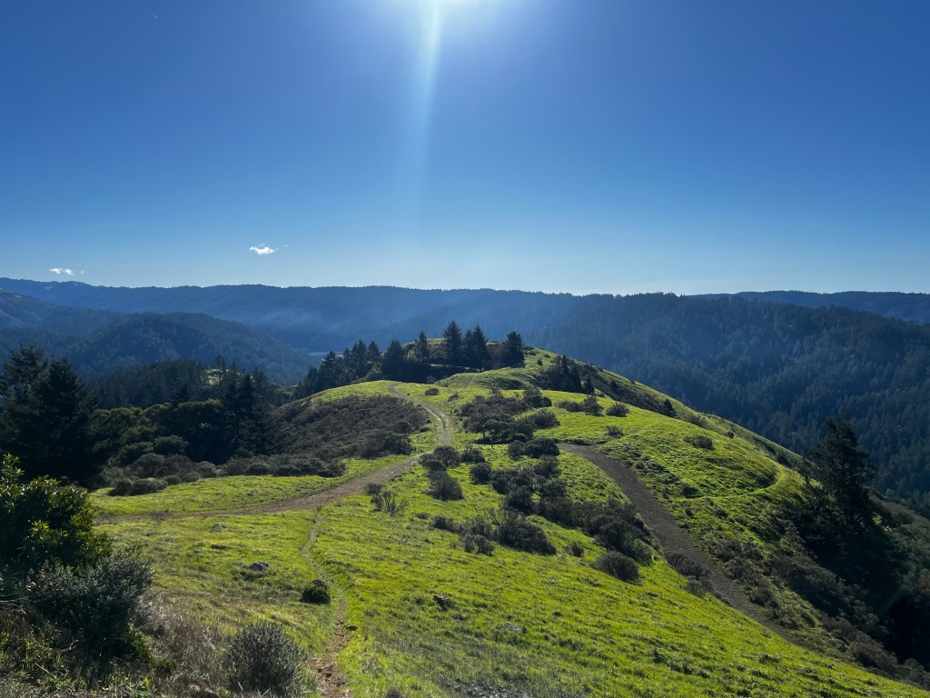
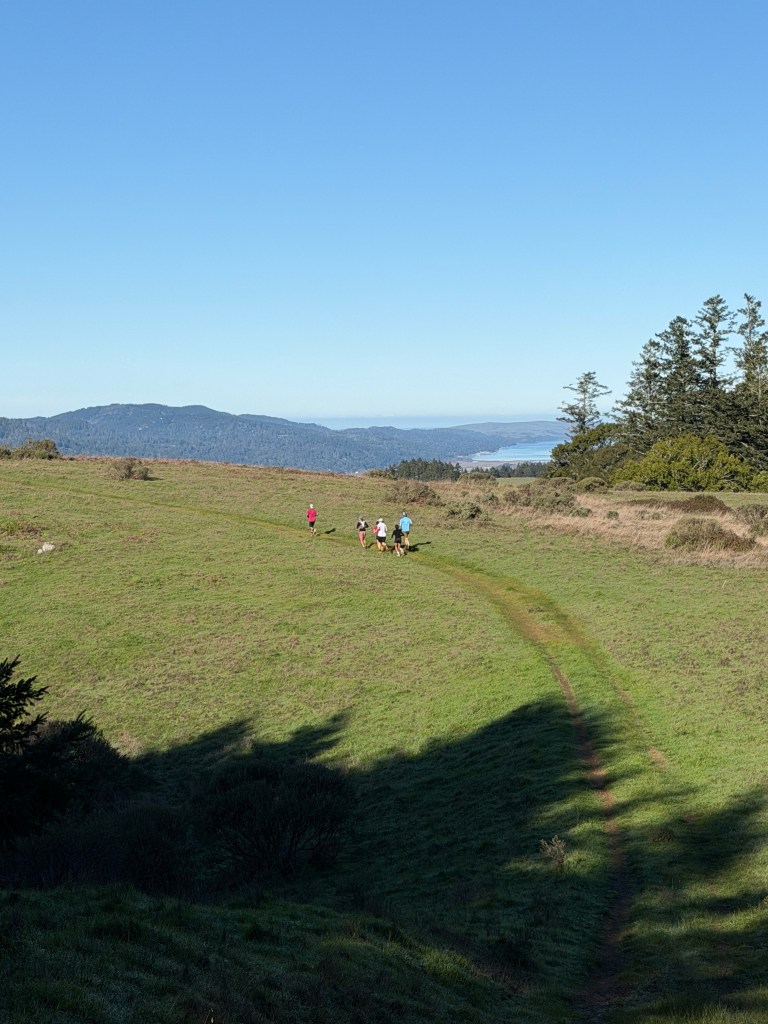
One you reach the end of Shafter, turn right onto Bolinas Ridge. This part of the trail is really beautiful and features vistas of nearby Point Reyes, cows, and a few sneak peaks of the ocean. Even after a rain it was totally runnable, albeit a bit muddy.
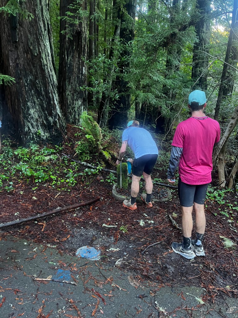
After about 3.8 miles veer right onto Jewel Trail for about ~1 mile and a 470ft descent. From there, take a right on the Cross Marin Trail and then take the first left ~0.7 miles later and you’ll arrive at some bathrooms and a water spout.
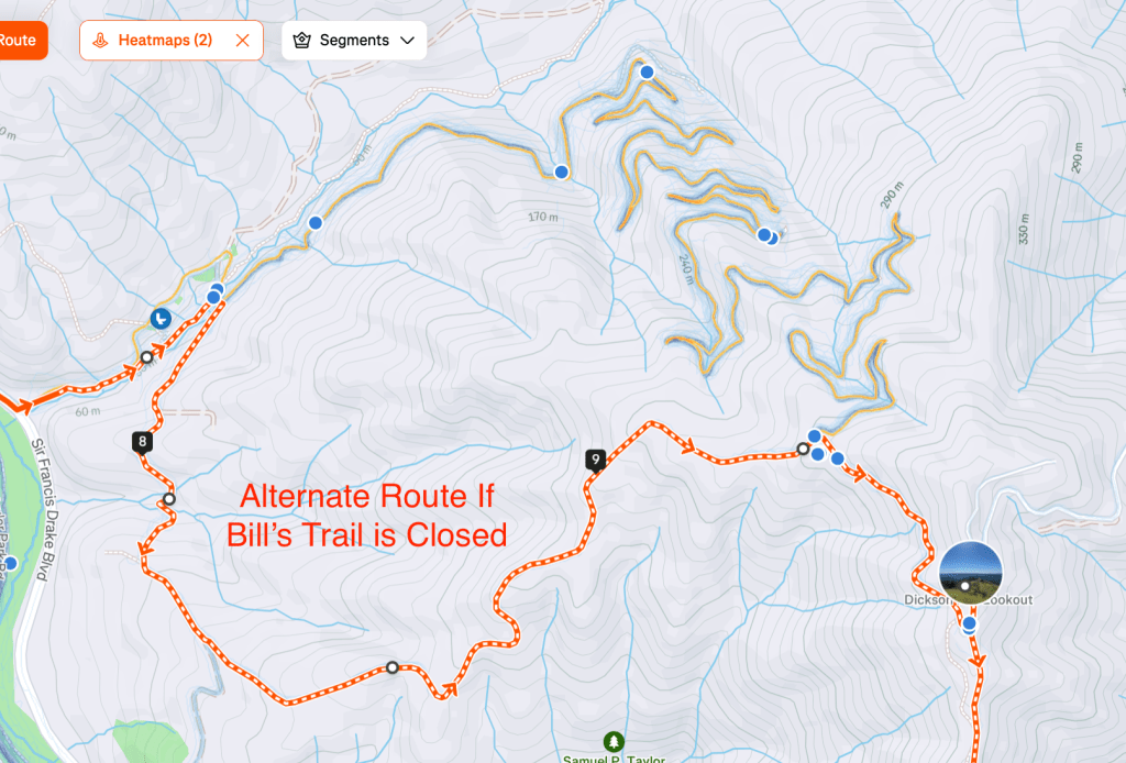
Briefly follow the unnamed road until Sir Francis Drake Blvd and go right. Run alongside the road for just over a quarter mile and then take a left on Devil’s Gulch Road. It should be relatively straight-forward to find Bill’s trail (There are signs) but it is closed for rainy season every year (we did not know this before completing the loop).
Make sure to check for trail closures before you go — the alternative route from Devil’s Gulch area is to take Gravesite Rd to Barnabe Fire Road up (another Shafter Grade-esque climb). This will instead yield a 12 mile run, still with ~2,700ft of climbing.
Bill’s Trail was incredible. My favorite part of the route, an absolute Bay Area hidden gem — steady 4 miles of climbing through lush forests on California carpet trails.
Once you finish Bill’s trail you have a steep fire road climb up to the Fire Lookout. Coach Brody, a seasoned local, says you cannot walk or the mountain lions will mistake you for livestock and eat you. As I am terrified of mountain lions, I did not walk.

After the summit, you follow the Barnabe Fire Road down for a steep descent. It is not technical, but you will lose ~1,200ft in less than two miles. At the bottom, take a left on the Cross Marin Trail and she’ll take you back to your car!
Overall, this was a great route with plenty of “amenities”. After the run we went to Good Earth in Fairfax (~20 minutes away) for sandwiches and smoothies. If you have any thoughts on these trails or this route, leave me a comment at the bottom of the post!
Modifications
You can modify the route to be shorter in two ways: cut off the climb up and down Barney or cut off Shafter, Bolinas Ridge and Jewel. If you have a group with varying comfort levels with trail running, Mod 1 allows a seamless departure from the 15-mile group after Jewel trail, where they will take the Cross Marin Trail all the way back.
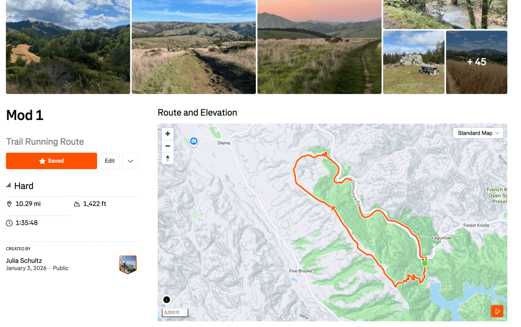
https://www.strava.com/routes/3442596071828406904
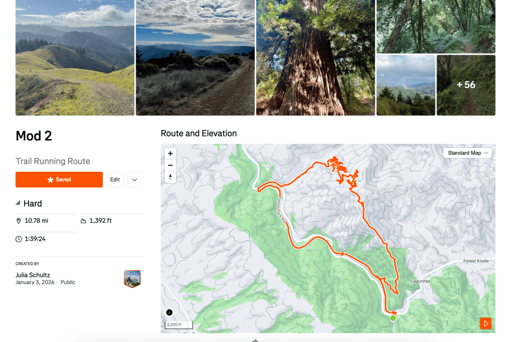
Mod 2 is effectively a different run. Mod 2 actually has the group running up Barnabe Fire Road and down Bill’s trail to have a more flowy descent. It is really up to you and your preferences if you prefer steep up or steep down.